EVERYTHING YOU NEED TO KNOW ABOUT LUXEMBOURG BELGIUM
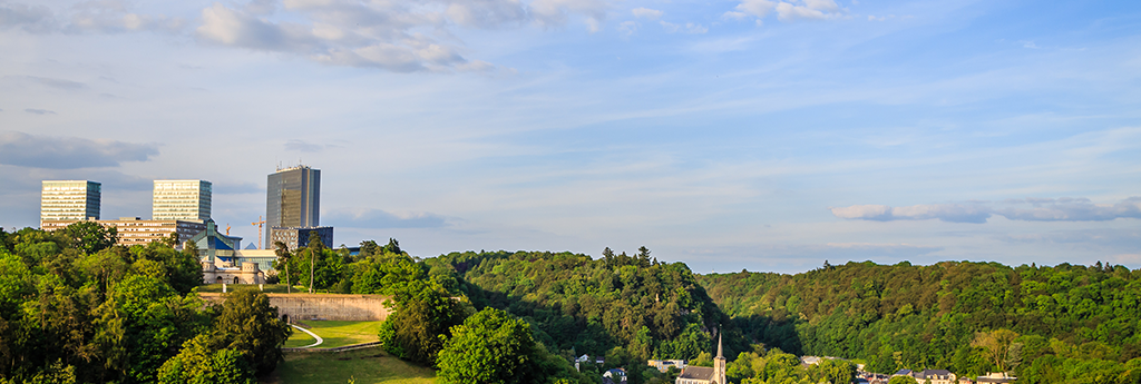
Being the southernmost province of Belgium and Wallonia province, Luxembourg has its borders with Luxembourg, France at the Grand Dutchy and the Belgian provinces of Liege and Namur. Thick and green forests, low mountains and rolling hills cover this landlocked country which also has a rigid plateau in the northern region. The highest point of Luxemburg is Burgplatz which is 1,843 ft and the important rivers that flow through this country are Fisch, Alzette and Moselle. The total area is 2,588 sq km and is smaller by a small margin to the Rhodes Island. The terrain is mostly comprised of slight mountainous land and uplands, shallow valleys and rolling uplands. The Bon Pays in the south of Luxemburg is fertile where agriculture is the main occupation. Oesling and Guttland are the two geographical areas, where 828 square kilometers (33%) of wooded areas cover Oesling and the remaining 68% of the country is the Guttland region where there are the sandstone plateau and the Moselle Valley. Luxembourg and the areas surrounding it are places of tourist interest.
Beautiful local sights and attractions
Discover a selection of the most beautiful places and attractions in LUXEMBOURG BELGIUM
History
It was Austria, France and Spain who took turns to hold the city of Luxembourg from the 15th to 18th century, after which in the year 1815 this countr...
Read MorePopulation
The population of Luxembourg as in July, 2016 stood at 582,291 among which the urban population accounted for 90.2%. The sex ratio stood at 1.06 males...
Read MoreClimate
Luxembourg experiences a temperate climate typical of those of the West European nations. There are no extremities and the summers are cool while the ...
Read More
Video about LUXEMBOURG BELGIUM
Get your book about
LUXEMBOURG BELGIUM
Ready to go? Get to the heart of LUXEMBOURG BELGIUM with one of in-depth, award-winning guidebooks.
More about this Book