Properties for sale in LE PLAN DE LA TOUR
Visit and discover Le Plan de la Tour beautiful nature & the best spots
EVERYTHING YOU NEED TO KNOW ABOUT LE PLAN DE LA TOUR
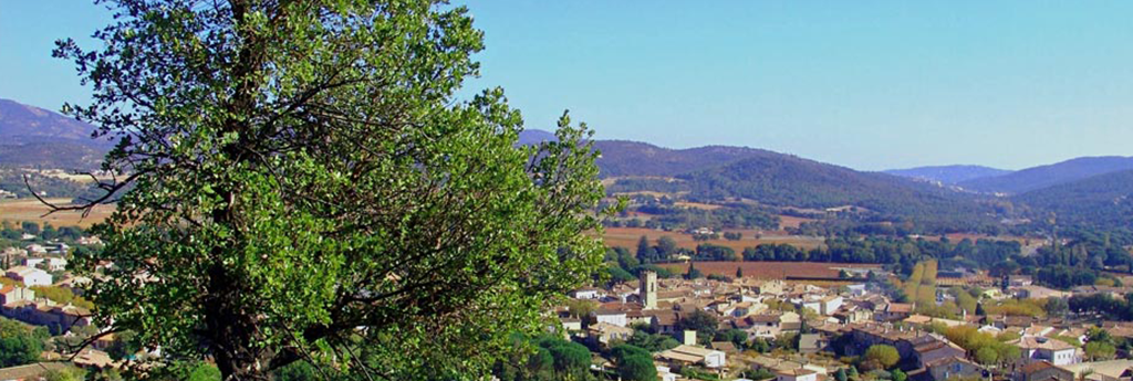
Le Plan de la Tour is a small village in the VAR region of South-eastern France. It lies in the Provence of Alpes Cote d’Azur. The village covers a total area of 36.8 sq.km. It is surrounded by dense forests of pines, oaks and chestnuts on all the sides. The people here follow a simple lifestyles and the village is away from the hustle-bustle of city life. Le Plan de la Tour is situated in the heart of the Massif des Maures Mountains. French is the official language spoken in the village.
Beautiful local sights and attractions
Discover a selection of the most beautiful places and attractions in LE PLAN DE LA TOUR
History
The village remained uninhabited for a long period of time. The 16th century witnessed the development of the village. New buildings, churches and cha...
Read MorePopulation
The census of 2006 records a total population of 2,747 and the population density is 75 per sq.km in the village....
Read MoreClimate
You will find mild and temperate climatic conditions in the village. July records for the hottest month of the year with an average temperature of 22⁰...
Read More
Video about LE PLAN DE LA TOUR
Get your book about
LE PLAN DE LA TOUR
Ready to go? Get to the heart of LE PLAN DE LA TOUR with one of in-depth, award-winning guidebooks.
More about this Book