Introduction to the Costa Blanca: The Jewel of the Spanish Coast
Nestled amidst the glistening azure waters of the Mediterranean, the Costa Blanca stands as one of Spain’s most captivating coastal regions. Renowned for its sun-drenched beaches, charming historical towns, and vibrant culture, Costa Blanca is not just a destination—it's a tapestry of experiences waiting to be explored. For travelers, property investors, and adventurers alike, understanding the intricacies of its geography is essential. That is where the detailed Costa Blanca Kaart—map—becomes your indispensable companion. In this article, we embark on a profound journey through the region, harnessing the power of cartography to reveal hidden treasures, local secrets, and the undeniable allure of this Mediterranean paradise.
Understanding the Costa Blanca: Geography & Overview
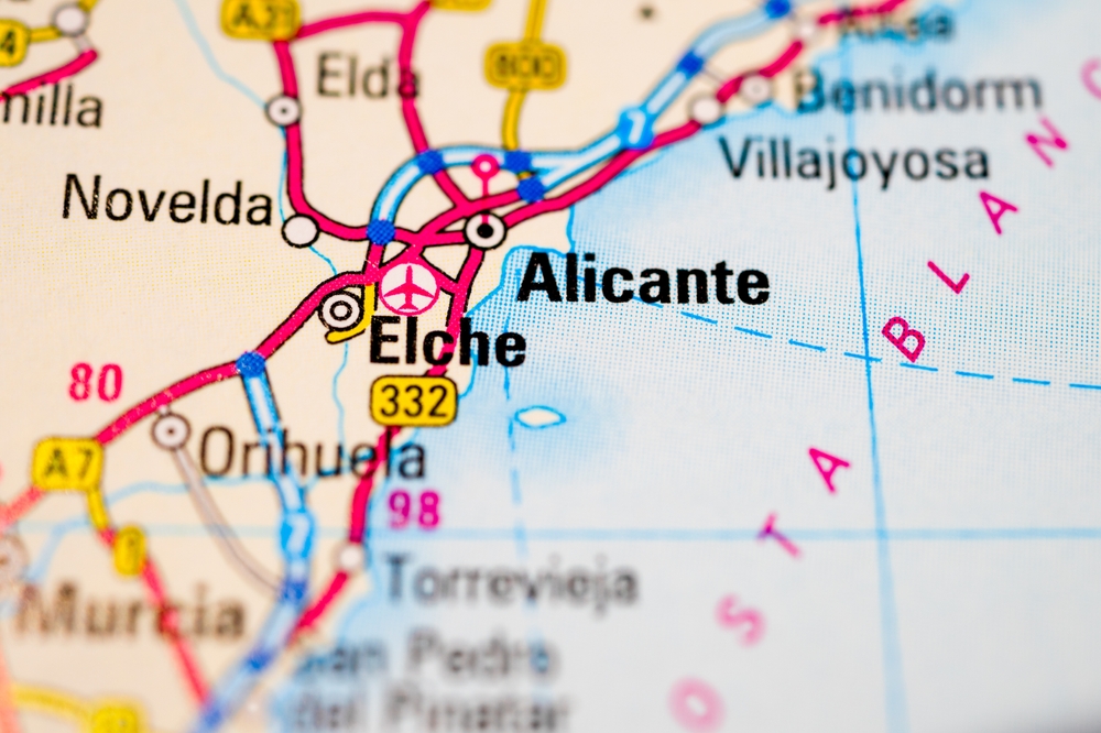
Costa Blanca—meaning “White Coast”—extends for approximately 200 kilometers along the southeastern coast of Spain, within the province of Alicante. Its pristine beaches, towering cliffs, and picturesque hinterlands are framed by the sparkling Mediterranean Sea to the east and a dramatic mountainous hinterland to the west.
- Provincial Boundaries: The Costa Blanca is primarily situated in the province of Alicante, which is part of the Valencian Community.
- Major Cities: The region boasts vibrant cities such as Alicante, Benidorm, Denia, Calpe, Altea, and Torrevieja, each illustrated in detail on the Costa Blanca Kaart.
- Inland Charms: Beyond the coast, the map reveals a multitude of inland villages, vineyards, and natural parks that offer an authentic Spanish experience.
Whether you are a visitor seeking relaxation, a lifestyle seeker searching for your next home, or a curious traveler aiming for adventure, the Costa Blanca’s geography—flourishing in diversity—is best appreciated through a comprehensive map.
Decoding a Gedetailleerde Kaart: What to Expect
A truly gedetailleerde kaart (detailed map) of the Costa Blanca serves much more than navigation. It is a visual narrative, blending practical information with local insights. The ideal map highlights:
- Major and Minor Roads: From the fast AP-7 motorway connecting towns and villages to scenic coastal drives.
- Beaches and Coves: Distinguishing between popular family-friendly playas and secluded “calas” for those seeking tranquility.
- Towns and Villages: Urban centers, hidden inland gems, fishing villages, and modern resorts are clearly marked.
- Sights and Landmarks: Castles, churches, parcs naturels, and cultural venues are pinpointed for easy discovery.
- Essential Services: Hospitals, parking, emergency services, and public transport hubs for seamless planning.
With this granularity, travelers and property buyers alike can immerse themselves in the Costa Blanca, making informed choices—whether for leisure, investment, or relocation.
The Northern Costa Blanca: From Denia to Calpe
The northern segment of the Costa Blanca reveals a landscape where lush mountains cascade into crystalline seas. This area is celebrated for its natural drama and unique blend of traditional and modern attractions.
Denia: Gateway to the North
Denia, perched at the northernmost tip of the Costa Blanca, serves as a primary entry point. The Costa Blanca Kaart displays its ferry connections to the Balearic Islands, medieval castle towering over the city, and its bustling port area. Explore the vast Las Marinas and Las Rotas beaches, mapped out with clarity to highlight both their accessibility and natural value.
Javea (Xàbia): The “Pearl of the Mediterranean”
Javea stands out for its diverse districts: the old town with gothic architecture, the bustling harbor, and the sandy Arenal beach, all connected by a scenic coastal road. The map provides details on picturesque coves, such as Cala Granadella and Cala Portixol, cherished by divers and snorkeling enthusiasts.
Moraira: Seaside Serenity
This exclusive coastal enclave is renowned for its protected pine zones, marina, and striking El Castillo. The detailed kaart demarcates residential areas, hidden beaches like El Portet, and routes leading into the lush valleys of Teulada.
Calpe: Iconic Coastal City
Dominated by the Peñón de Ifach—a towering limestone outcrop visible on all comprehensive maps—Calpe unites historical charm and modern amenities. The Costa Blanca Kaart highlights a labyrinth of ancient streets, celebrated blue-flag beaches, and salt flats frequented by flamingos.
The Heart of Costa Blanca: Altea, Benidorm, and Surroundings
At the heart of the Costa Blanca, tradition and excitement collide. This region is defined by its contrasts—from quiet artistic havens to vibrant leisure capitals.
Altea: Cultural and Artistic Legacy
Altea is distinguished on every well-crafted map by its whitewashed old town crowning a hillside, blue-domed church, and pebble beaches. The Costa Blanca Kaart guides visitors through cobbled paths, panoramic viewpoints, and into nearby forested hills and orchards.
Benidorm: A Vertical Metropolis
Dubbed the “New York of the Mediterranean,” Benidorm’s high-rises are unmistakable. Maps highlight not only its Levante and Poniente beaches, but also its vibrant nightlife, amusement parks (Terra Mítica, Aqualandia), urban districts, and expansive promenades. The kaart also marks serene natural areas like the Sierra Helada Natural Park, a striking contrast to the city’s bustling resort core.
Villajoyosa: The Town of Color
Renowned for its multi-colored seafront homes, chocolate heritage, and authentic fishing port, Villajoyosa is carefully mapped with walking tours, beach zones, and local cultural attractions for in-depth exploration.
The Southern Costa Blanca: Torrevieja, Orihuela Costa and Beyond
Moving south, the landscape opens into salt lagoons, fertile plains, and ever-expanding coastal resorts. The southern Costa Blanca, as visualized through detailed mapping, is a tapestry of natural beauty and urban innovation.
Torrevieja: Vibrant and Accessible Living
At the heart of the southern coast, Torrevieja’s detailed depiction on the Costa Blanca kaart includes its unique pink and green salt lakes (Laguna Rosa and Laguna Verde), extensive promenades, popular beaches, and bustling city center. The urban layout, residential neighborhoods, and crucial service nodes—such as hospitals and cultural centers—are presented for both tourists and those considering a permanent move.
Orihuela Costa: A Patchwork of Urbanizations
Orihuela Costa, distinct from Orihuela town further inland, is a coastal district renowned for championship golf courses, beachside urbanizations, and leisure centers—all meticulously detailed on the kaart. Each coastal zone, from Punta Prima to Campoamor, is highlighted for its unique character, facilities, and accessibility. The map also denotes shopping meccas, such as Zenia Boulevard, and routes to natural parks and rural escapes.
Guardamar del Segura: Where Nature Meets the Sea
This coastal gem is marked by vast sand dunes, pine forests, and unspoiled beachfronts, protected as natural parks. The kaart outlines walking trails, recreational areas, and zones of environmental interest, assisting eco-tourists and nature lovers in their discoveries.
Santa Pola & Elche: Salt, History, Palms
Santa Pola, mapped as a hub of fishing heritage, salt flats, and island excursions (to Tabarca), connects seamlessly with Elche, home to the world-famous Palmeral—a UNESCO World Heritage Site. The kaart showcases routes between these cities, featuring attractions such as the municipal park, palm groves, and archaeological treasures.
Essential Attractions Highlighted On the Costa Blanca Kaart
A gedetailleerde kaart reveals far more than towns and roads. It brings cultural icons, natural wonders, and tourist must-sees to the forefront, offering a roadmap for inspired experiences. Key attractions that stand out on the Costa Blanca Kaart include:
- Castillo de Santa Bárbara (Alicante): Perched atop Mount Benacantil, this medieval fortress is an iconic waypoint on every map.
- Peñón de Ifach (Calpe): Costa Blanca’s signature landmark for hiking and panoramic views.
- Tabarca Island: Spain’s smallest inhabited island, off the coast of Santa Pola, renowned for its marine reserve and traditional cuisine.
- Fuentes del Algar: A network of natural springs and waterfalls mapped inland from Callosa d’en Sarrià.
- Guadalest: A fortified village perched atop a mountain pass, mapped with routes revealing castle ruins and ethno-cultural museums.
- Sierra de Mariola & Montgó Natural Park: Hiking, biodiversity, and rustic village trails traceable across inland stretches of the kaart.
With these attractions clearly marked, both new and returning visitors can shape bespoke journeys, ensuring discovery at every turn.
Beaches, Coves, and The Coastline: Mapping Coastal Gems
Costa Blanca’s coastline showcases an unparalleled mosaic of beaches, coves, and sea cliffs—each distinctly detailed for the discerning traveler. The Costa Blanca kaart distinguishes each according to beauty, amenities, and accessibility.
Main Beaches
- Playa de San Juan (Alicante): Stretching for several kilometers, this golden sandy beach is highlighted for its family-friendly facilities, accessibility, and active water sports scene.
- Levante & Poniente (Benidorm): Two adjacent beaches mapped with promenades, entertainment facilities, and accessible points.
- Playa de La Fossa (Calpe): Set at the foot of the Peñón de Ifach, this is a hub for sun-seekers and families.
- Arena Beach (Javea): Renowned for its soft sands, lively bars and restaurants, and bustling nightlife.
- Playa del Cura and Los Locos (Torrevieja): Central city beaches, easily found and serviced with all urban conveniences.
Secluded Coves and Blue Havens
Look to the kaart for the region’s lesser-known “calas,” such as Cala Ambolo (Javea), Cala Moraig (Benitachell), and Cala Tío Ximo (Benidorm), often accessible via hiking trails or winding coastal roads. These coves are ideal for snorkelers, nature enthusiasts, and those seeking respite from the crowds.
The kaart’s legend typically distinguishes between family beaches (equipped with lifeguards and services) and natural coves (requiring a hike or drive), ensuring all sunseekers find their ideal shore.
Navigating By Road: Major Routes and Inland Excursions
The importance of road networks cannot be overstated for those exploring the Costa Blanca’s breadth. The gedetailleerde kaart provides comprehensive overviews:
- AP-7 Motorway: The coastal backbone, offering swift passage between northern and southern cities.
- N-332 Highway: A scenic alternative, running parallel to the sea and weaving through towns for a more leisurely drive.
- Inland Roads: Routes towards the Jalón Valley, Guadalest, and Elche, granting access to wine regions, history, and mountain scenery.
Each route is illustrated with service stops, viewpoints, and attractions, empowering road-trippers and daily commuters alike. For those seeking adventure, the kaart unfolds hiking routes, mountain passes, and cycling circuits known only to locals.
Public Transport on the Costa Blanca: Visualizing Connections
Going beyond roads, the modern Costa Blanca kaart delineates all modes of public transport:
- Tram Lines: Connecting Alicante to Denia, the tram route is detailed, showing stops at Playa San Juan, Benidorm, Altea, and more.
- Railways: The kaart traces national and regional lines for effortless travel between Alicante, Elche, and Murcia.
- Buses and Urban Connectivity: Comprehensive bus networks within cities and along the coast, with terminals and strategic stops marked.
- Ferry Connections: Ports such as Denia display ferry routes to Ibiza and Mallorca.
- Airports: Alicante-Elche Airport is prominently displayed, with road and public transport links illustrated for convenience.
With all connections detailed graphically, journeys—whether for business, travel, or daily living—are simplified.
Inland Villages and Nature: Discoveries Off the Beaten Path
The Costa Blanca Kaart is indispensable for venturing beyond the coast. The mountains and valleys to the west are rich with culture, gastronomy, and nature—mapped for the curious explorer.
Charming Villages
- Guadalest: Known for its medieval fortress, azure reservoir, and panoramic vistas.
- Jalón/Xaló: Center of the region’s wine country, featuring bodega routes and rural market days.
- Polop: A whitewashed village with dramatic views and ancient springs.
- Alcoy: Industrial past meets modern culture, with bridges, festivals, and mountain excursions all mapped in detail.
Parks and Natural Wonders
Natural reserves such as Montgó Natural Park, Sierra de Mariola, and Las Lagunas de la Mata y Torrevieja appear prominently, guiding hikers, cyclists, and wildlife enthusiasts to their starting points, trails, and interpretive centers.
For those considering property investment, the kaart signals tranquil valleys and green oases where lifestyle properties abound, offering a distinctly different pace from the dynamic coast.
Property, Investment, and Lifestyle: Reading the Kaart for Opportunity
One of the greatest powers of a gedetailleerde kaart is its ability to transform mere visitors into informed investors and residents. By visualizing the relationships between coast, amenities, services, and transport, the map guides property seekers toward optimal choices.
Residential Zones
- Urbanizations: The kaart distinctly marks major residential complexes on the outskirts of cities and within golf valleys, highlighting areas favored for their tranquility, green spaces, and security.
- Villas and Rural Properties: Inland towns and countryside plots are detailed for lovers of peace, agriculture, or equestrian adventures.
- Seaside Apartments: Busy beachfront areas are mapped for those seeking vibrant, walkable lifestyles with direct access to entertainment and the sea.
With every detail at your fingertips, decision-makers are empowered to evaluate distance to services (schools, hospitals, shopping), elevation, views, and neighborhood ambiance before commencing their property journey with IMMO ABROAD as their dedicated partner.
Culture, Festivities, and Gastronomy: Mapping the Local Experience
No map of the Costa Blanca is complete without attention to culture—bringing to life fiestas, traditions, and flavors.
Yearly Festivities
- Fallas of Valencia and Bonfires of San Juan: The kaart highlights festival centers, parade routes, and main event squares in major towns.
- Moors and Christians: Unique to the region, these exuberant festivities are mapped throughout the calendar, allowing visitors to plan their stays around dramatic processions.
- Semana Santa (Holy Week): Routes for processions in Alicante, Orihuela, and Elche are drawn for culture seekers.
Culinary Destinations
Markets, major gourmet hotspots, and traditional “chiringuitos” (beach bars) are indicated, introducing readers to local rice dishes, fresh seafood, and artisan wines. The kaart can guide you to:
- Mercado Central (Alicante): For local produce and culinary delights.
- Wine Country (Jalón Valley): For tasting and touring local bodegas.
- Seafood Taverns (Santa Pola): Fresh catch of the day moments from port to plate.
Whether you are pursuing a feast or a festival, the gedetailleerde kaart ensures you never miss a cultural beat.
Practical Uses of the Costa Blanca Kaart: Tips for Every User
A detailed kaart can serve a multitude of audiences, each with unique goals:
- Tourists: For sightseeing, beach-hopping, or planning day trips.
- Residents: To locate services, leisure centers, schools, and medical facilities quickly and accurately.
- Property Buyers: To assess proximity to amenities and transport, identify neighborhood features, and choose future hot spots.
- Business Owners: To evaluate market opportunities based on population density, tourist flows, and growth patterns.
- Adventurers: For plotting hiking, cycling, and nature excursions, far beyond the reach of usual GPS navigation.
By embracing both print and digital versions of the Costa Blanca kaart, users can combine portable convenience with interactive, real-time exploration as they move between sun-kissed beaches, mountain villages, and urban centers.
How to Choose the Best Costa Blanca Kaart for Your Needs
With so many options available today—from free tourist handouts to professional-grade atlases and smartphone apps—choosing the right map can maximize your Costa Blanca experience.
Types of Karten Available
- Tourist Maps: Often available at information centers, these maps provide user-friendly overviews with attractions, walking routes, and local highlights.
- Topographical Maps: Essential for hikers and cyclists, these track elevation, paths, and natural obstacles, aiding in safe exploration.
- Transport Maps: Specialized for public transport users, with bus, tram, and rail routes.
- Real Estate/Investment Karten: Designed for property seekers, these indicate residential zones, price gradients, schools, and potential growth areas.
- Digital Apps: From GPS-based navigation to AR-enhanced travel guides, interactive maps overlay real-time data on attractions, restaurants, and traffic.
Consider your primary activities—leisure, business, discovery—when selecting the most suitable kaart. Many users combine several sources, cross-referencing between paper and mobile technology to ensure accuracy and richness of data.
Costa Blanca Kaart and the Future: Smart Navigation and Beyond
As technology evolves, so too does the experience of discovering the Costa Blanca. Today’s digital kaarten integrate satellite images, virtual tours, live updates, and customizable features, opening new doors to exploration.
Innovations in Mapping
- 3D Mapping: Visualize elevations, building footprints, and panoramic viewpoints for a more immersive planning experience.
- Augmented Reality (AR) Overlays: Use your smartphone camera to view instant information about landmarks, restaurants, or property listings as you explore.
- Live Data Integration: See real-time festival schedules, traffic conditions, and weather changes mapped as you go.
- Custom Routes and Personalization: Create and save bespoke itineraries—beaches, hiking, culinary tours—based on your unique interests and timeline.
These innovations underscore a simple truth: the Costa Blanca Kaart is not a static document, but an evolving companion, adapting to fit the dreams of each visitor and resident.
Why a Gedetailleerde Kaart Is Indispensable for Discovering Costa Blanca
The enchanting Costa Blanca deserves more than a cursory glance. Only through a gedetailleerde kaart can explorers unveil every layer of this region:
- From hidden coves and ancient castles to bustling ports and tranquil valleys
- From burgeoning property hotspots to time-honored rural villages
- From high-season festivities to secluded nature trails that escape the ordinary
The kaart transforms the abstract into actionable knowledge, fostering a deep connection with the land, its people, and its opportunities.
Laid Out for Every Pursuit
- Leisure: Beachgoers and sunseekers discover the best spots for relaxation.
- Adventure: Hikers and cyclists push beyond the tourist trail, uncovering the true wild heart of Costa Blanca.
- Residential and Investment: Those relocating or buying a home tap into the data that shapes wise decisions.
- Cultural: Aficionados trace the epicenters of music, art, and tradition.
Every journey through Costa Blanca—with IMMO ABROAD guiding your steps—is made richer, more secure, and infinitely more rewarding by the gedetailleerde kaart.
Conclusion: Your Ultimate Companion—The Costa Blanca Kaart
The Costa Blanca, with its sunlit beaches, historic towns, lively cities, and lush hinterlands, is a destination brimming with possibility. Yet, to truly understand its scope—to experience its contrasts, seize its opportunities, and cherish its hidden corners—one must turn to the power of precise, up-to-date cartography.
The Costa Blanca Kaart is more than a navigation tool; it is a passport to a lifestyle marked by discovery and convenience. Whether for travel, business, relocation, or simple curiosity, it becomes your ultimate companion—transforming expectations into experience, and dreams into reality.
With every town, road, beach, and natural wonder mapped in enduring detail, the Costa Blanca kaart crafts a narrative unique to you. Let it be your guide as you explore, invest, or settle in this Mediterranean paradise—assured that with IMMO ABROAD, every journey begins and ends with clarity, confidence, and the promise of something extraordinary.